Dublin Core
Title
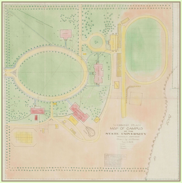
Working Plan Map of the Campus of the State University, Missoula, Montana
Subject
University of Montana (Missoula, Mont.); campus plan
Description
Map showing current campus grounds, structures, water, sewer and steam lines.
Creator
J.H. Bonner
Source
Digitized on 9/14/2011, originals were scanned in color at 400 dpi on a Colortrac 5480e large format scanner and saved as TIFF files. JPEG derivatives were made from the original TIFFS using Photoshop.
Date
circa 1915
Contributor
Archives & Special Collections, Maureen and Mike Mansfield Library, The University of Montana
Rights
Copyright to this collection is held by the Maureen and Mike Mansfield Library, The University of Montana-Missoula. This image may also be protected by copyright. Permission may be required for use. For further information please contact Archives and Special Collections.
Format
image/jpeg
Language
en
Type
image
Coverage
The University of Montana-Missoula campus
Still Image Item Type Metadata
Library Call Number
RG 39, Map Drawer X-1, 2004-18 Campus Drawing
Original Format
plan
Physical Dimensions
19 x 19"
Image Viewer
Click below to view an image using the Zoom.it viewer.

