Dublin Core
Title
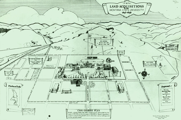
Illustrated Map of Land Acquisitions of Montana State University 1893-1936
Subject
University of Montana (Missoula, Mont.); campus plan; land acquisitions
Description
Photograph of map showing the history of land acquisition by the University of Montana-Missoula.
Creator
Data by J.B. Speer, Map drawn by Will Olson
Source
Digitized on 9/9/2011 using an HP Scanjet 8200 at 200 PPI, 24 bit RGB. Web-viewable images created from master TIFF using Photoshop CS.
Date
January 1936
Contributor
Archives & Special Collections, Maureen and Mike Mansfield Library, The University of Montana
Rights
Copyright to this collection is held by the Maureen and Mike Mansfield Library, The University of Montana-Missoula. This image may also be protected by copyright. Permission may be required for use. For further information please contact Archives and Special Collections.
Format
image/jpeg
Language
en
Type
image
Still Image Item Type Metadata
Library Call Number
RG 6, Box 1, Folder 2 Aerials and Views
Original Format
photo

