1
THE CAMPUS AS A CULTURAL RESOURCE

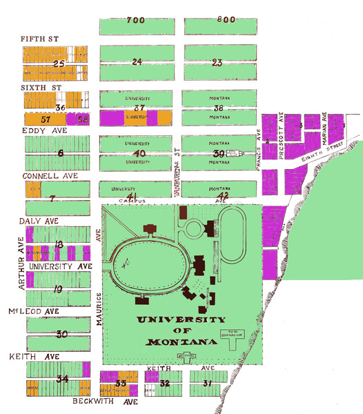
Map showing campus property acquired from 1960-2013 in orange.

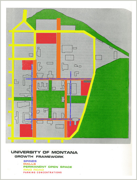
Draft Growth Framework Plan, 1971.

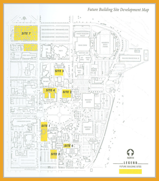
Map of future building sites, 2002.
The architectural firm of Lawrence Lackey and Associates was hired in 1971 to complete a “Growth Framework Plan” for the university. The plan focused on the reutilization of the existing campus grounds. The campus was reorganized to include specific architectural features called spines, malls, a ring road, parking concentrations and permanent open space. Spines were walkways that doubled as emergency lanes and connected existing and future buildings. Malls were a “sequence of spaces, landscaping and features for use as main paths through campus for pedestrian circulation.” The ring road was to run around the entire campus and to contain traffic to the external boundary. Parking was to be concentrated in lots at the edge of the road. The plan dictated that the campus permanently preserve some open space to “maintain a quality of environment.”
During the 1980s the university continued to acquire property along the 600 block of Fifth and Sixth Streets and Eddy Avenue, and made a decision not to acquire property south of Beckwith Avenue as the land fell out of the Gilbert-Carsley plan boundary. The Campus Development Committee spent the 1990s working to expand the campus and to protect the historical integrity of the landscape. They designated areas of campus, like the path from the Social Science Building across the oval to the Chemistry Building, “vistas” and stated that they were to be permanently free of visual obstruction.
The most recent campus plan was completed in 2002. The 2002 University of Montana-Missoula Master Campus Plan focused on dividing the campus up into use-zones like academics, housing and athletics, and the acquisition of the few remaining privately held lots along the 600 block of Fifth and Sixth Streets and Eddy Avenue.

